Interactive Maps

The Census & Economic Information Center of the Montana Department of Commerce has compiled the following interactive maps.

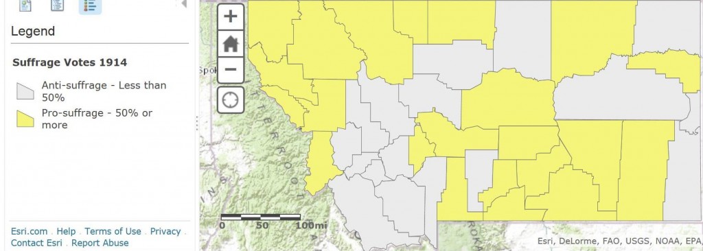
1914 Suffrage Vote Map

This map shows which Montana counties supported--and opposed--women's suffrage during the 1914 vote. Click on the image to view an interactive map that shows county level details (including actual vote tallies) when viewers click on a specific county. (Note that this map shows the counties as they existed in 1914. New counties were formed after 1914.) Map courtesy Montana Census and Economic Information Center.
This map shows which Montana counties supported–and opposed–women’s suffrage during the 1914 vote. Click on the image to view an interactive map that shows county level details (including actual vote tallies) when viewers click on a specific county. (Note that this map shows the counties as they existed in 1914. New counties were formed after 1914.) Map courtesy Montana Census and Economic Information Center.

Leave a Reply

Your email address will not be published. Required fields are marked *